Illyrians and Ancient Albania: Kingdoms, Rome and King Pyrrhus
The Illyrians built three kingdoms in what is now Albania before Rome conquered the region in 168–167 BC. Meet their tribes, Queen Teuta, King Pyrrhus and the Dardanians.

Contents9 sections
- Prehistory
- Early humans and their finds
- Society and belief in prehistoric times
- Who were the Illyrians?
- The Pelasgians
- The borders of Illyria
- The main tribes
- Cities, economy and language
- Illyrian cities
- Economy, coinage and the fleet
- Society and royal power
- The three Illyrian kingdoms
- The Illyrian–Roman wars
- Illyria under Roman rule
- The Great Illyrian Revolt
- Epirus and King Pyrrhus
- Pyrrhus and the "Pyrrhic victory"
- Epirus after Pyrrhus
- The Dardanian kingdom
- Dardania, Macedonia and the Celts
- Dardania and Rome
- What ancient authors wrote about the Illyrians
- FAQ
The ancient history of Albania is the story of the Illyrians, the Epirotes and the Greek colonies on the Adriatic. Three Illyrian kingdoms rose and fell here, and the Epirote state of Pyrrhus flourished in the south. The Dardanian kingdom grew up on the territory of today's Kosovo. Rome subdued them one after another: the Illyrian lands and Epirus in 168–167 BC, Dardania only at the end of the 1st century BC.
This is the first chapter of our guide to the history of Albania. It covers the period from the first human settlements to the Roman conquest, with the key names and dates. Separate sections look at Illyrian cities and the Illyrian economy, life under Roman rule and the last great revolt against Rome.
Prehistory
People lived in what is now Albania long before the Illyrians. Neanderthals were here in the Middle Palaeolithic, and the Konispol cave in the south of the country holds traces of a settlement from around 24,700 BC. Prehistory lasted about 2 million years — until people began to use metals.
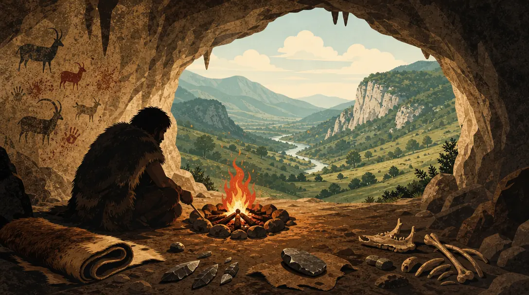
The whole of human history is divided into two great eras, prehistoric and historical. The dividing line between them is the beginning of the use of metals. Writing was not yet known in prehistory, which is why it is called "history without written documents": everything we know about it comes only from archaeological finds.
Prehistory is also called the Stone Age, which is divided into the Palaeolithic, the Mesolithic and the Neolithic. It was followed by the Age of Metals: the Copper, Bronze and Iron Ages. Each period left its own mark on the region.
| Period | Time | What appeared |
|---|---|---|
| Palaeolithic | until ~12,000 years ago | Neanderthals, later settlements, caves, the first art |
| Mesolithic | c. 10,000–7000 BC | New flint tools, the first attempts at farming and domesticating animals |
| Neolithic | c. 7000–3500 BC | Polished tools, permanent settlements, farming, herding, pottery, the bow and arrow |
| Copper Age (Eneolithic) | c. 3500–2100 BC | Copper, although stone remains the main material |
| Bronze Age | c. 2100–1200/1100 BC | Walled settlements, burials under mounds (tuma, "burial mound") |
| Iron Age | from c. 1100/1000 BC | Hilltop settlements; the Illyrian tribes take shape |
The boundaries between periods vary slightly from book to book, so the dates in the table should be treated as approximate. What matters more is the order of the eras and what each one brought that was new.
The main Neolithic culture of south-eastern Albania is the Maliq culture, named after the settlement of Maliq near Korçë. The sites of Vashtëmi, Dunavec and Podgorie are also attributed to it. Neolithic settlements were built in the open, in caves or on stilts (pile dwellings).
In the south, in Epirus, lay Dodona, a sanctuary with an oracle of Zeus. Herodotus called it the oldest in the Hellenic world, and Strabo wrote that it was founded by the Pelasgians.
Early humans and their finds
The earliest traces of humans in these lands date to around 100,000 BC. In the Palaeolithic, people lived by hunting and gathering. The Upper Palaeolithic is known for open-air sites, karst caves and the first examples of art.
The textbook map marks the Palaeolithic centres of Gajtan, Xarrë and Konispol, and among the Neolithic ones Cakran, Burimas, Dunavec and Podgorie. The settlement of Maliq is singled out: it has three layers, meaning that people lived there in different eras.
Maliq is one of the largest Neolithic settlements. It lay on the site of a former marsh near Korçë and was discovered in 1948. Pile dwellings have been found both at Maliq and at Dunavec.
The Mesolithic coincided with a time of major climate change. New flint tools appeared, and people tried for the first time to grow plants and domesticate animals. According to the textbook, the bow and arrow were already in use in the Neolithic, when the land also began to be worked with the hoe.
In the Metal Ages tools became stronger: they were made first of bronze, then of iron. Ploughing spread, and it was men's work.
Society and belief in prehistoric times
Prehistoric society was held together by blood kinship. The textbook describes its early form as matriarchal and holds that it was later replaced by a patriarchal clan system with the monogamous family; this is the scheme accepted in older school scholarship.
Neolithic religion worshipped nature and fertility, above all Mother Earth, and was polytheistic.
Over time, clan and tribal ties led tribes to unite into alliances and then to the emergence of the state. This path from tribe to alliance to state is the one the Illyrians follow in the sections below.
Who were the Illyrians?
The Illyrians were Indo-European tribes who held the western Balkans by the end of the Iron Age. The Albanian history textbook treats them as the region's native population. In its account, the Illyrians took shape here in the 2nd–1st millennia BC, in the Bronze and Iron Ages.
There are two views on where the Illyrians came from. One sees them as newcomers to the western Balkans. The other sees them as a local population that formed over a long period, and this is the view taken by the Albanian school of history. The name "Illyrians" first appears in Herodotus, around the middle of the 5th century BC.
In support of local origin, the textbook cites archaeological evidence: the settlement of Maliq, as well as burial mounds and pottery from Maliq, Vajzë, Mat and Glasinac.
Illyrian lands stretched from the Sava and Drava valleys in the north to the Morava and Vardar in the east. To the west and south they extended from the Adriatic and Ionian coasts as far as the Acroceraunian Mountains. Further south, down to the Ambracian Gulf, lived the Epirotes.
The Pelasgians
Ancient authors wrote of an even older population in these parts, the Pelasgians. Their country was called Pelasgia and their language Pelasgian. The Pelasgians were regarded as an ancient pre-Greek population of the Balkans and the Aegean.
Dodona is also linked to the Pelasgians: according to Strabo, it was they who founded the sanctuary. Herodotus and other ancient historians wrote about the Pelasgians.
The borders of Illyria
The textbook divides the Illyrian lands into two parts. Northern Illyria stretched from Istria to the Neretva river, and Southern Illyria from the Neretva to the Ambracian Gulf.
There is also a narrower concept, Illyria proper. This was the name for the lands from the Neretva to the Acroceraunian Mountains, that is, to the Karaburun peninsula and the Llogara range.
Next to the Illyrians lay other regions that are discussed below: Dardania, roughly present-day Kosovo, and Paeonia to its south.
The main tribes
There were many tribes, and different ones came to the fore in different centuries. These are the ones textbooks mention most often:
the Taulantii, around Epidamnus (Durrës), between the Mat and Shkumbin valleys;
the Ardiaei, around Lake Shkodër, with their centres at Rhizon and Scodra (Shkodër);
the Dardani, in and around the territory of modern Kosovo;
the Encheleae, by Lake Ohrid;
the Parthini in the Shkumbin valley, and the Dassaretae in south-eastern Albania;
the Amantes, in the hinterland of the Bay of Vlorë;
the Albani, in the area of Mat and Krujë.
The textbook gives more detail on where some tribes lived. The Ardiaei broadly held the lands between the Neretva and Kotor, while the Labeates lived near Shkodër. The Penestae settled in the valley of the Black Drin. The Parthini had their own political union, the Koinon of the Parthini.
In the north of the Illyrian world lived the Liburni, and on the Dalmatian coast the Dalmatae. The main centre of the Dalmatae was Delminium.
The geographer Ptolemy was the first to mention the Albani, in the 2nd century AD. He also named their city, Albanopolis, which is identified with Zgërdhesh near Krujë. According to a widely held view, the name "Albanians" comes from this tribe.
Ptolemy himself placed Albanopolis between the Mat and the Shkumbin.
The tribes shared a common culture. It shaped their way of life, their art, and their customs around birth, marriage and death, and the tribes traded actively with one another.
Cities, economy and language
The first Illyrian cities appeared at the end of the 5th century BC. They were built on hilltops and divided into zones: residential, public, religious, commercial and defensive. Their rise was preceded by advanced farming, herding and crafts, and by growing trade.
By then Greek colonies already stood on the coast. The Corinthians first founded Corcyra (Corfu). Around 627 BC, together with the Corcyraeans, they founded Epidamnus on Taulantian land; the city was later called Dyrrachium. Around 600 BC Corinthians led by Gylax founded Apollonia near Fier, originally called Gylakeia. Oricum had appeared by the middle of the 6th century BC. The colonies' population also included Illyrians, since the cities were founded on land the Illyrians already inhabited.
Colonies on this coast appeared from the end of the 7th century BC.
| Colony | When founded | Founded by |
|---|---|---|
| Corcyra (Corfu) | Before Epidamnus | Corinthians |
| Epidamnus (Dyrrachium, Durrës) | c. 627 BC | Corinthians and Corcyraeans, on Taulantian land |
| Apollonia (Gylakeia), near Fier | c. 600 BC | Corinthians led by Gylax |
| Oricum | By the middle of the 6th century BC | — |
The Roman poet Catullus called Dyrrachium "the tavern of the Adriatic" (the Albas textbook attributes these words to Cicero), and Cicero wrote of Apollonia as "a great and majestic city".
Language. Illyrian was an Indo-European language, and traces of it survive in modern Albanian. No Illyrian texts have come down to us, so the names of people and places are known only as Greek or Latin authors recorded them.
Religion. The Illyrians worshipped the great gods of the ancient world but gave them local features. The snake and the sun held a special place, and there were also myths about animals and natural phenomena.
Illyrian cities
The textbook identifies a first phase of city building in the 5th–4th centuries BC. It includes Rhizon, Ulcinj, Scodra, Lissus (Lezhë), Uscana, Damastion, Byllis, Amantia, Pelium and Phoenice.
Some ancient cities can be matched with modern ones: Amantia is linked with Vlorë, and Byllis with Ballsh. Royal tombs have been found at Selca e Poshtme near Pogradec, which is identified with ancient Pelium.
Illyrian cities flourished in the 4th–2nd centuries BC.
Economy, coinage and the fleet
The Illyrians grew grain, olives, grapes and fruit, and kept bees. Grain, olive oil, wine, honey and wax were produced for sale.
Herding was seasonal: in summer the flocks grazed in the mountains, and in winter they were driven down to the plains.
The Illyrian kings Monunius, Mytilus and Gentius, as well as the cities of Amantia, Byllis and Scodra, minted bronze and silver coins. The silver coin is known as the Illyrian drachma.
Greek and Roman sources show that the Illyrians developed seafaring, and piracy along with it. Their fast ship, the liburna, was later adopted by the Romans for their own fleet. For a long time the Illyrians dominated the Adriatic as far as Corfu.
Society and royal power
Illyrian society was divided into three layers: the wealthy, small free landowners and unfree people, mostly slaves. According to the textbook, a slave-owning society had taken shape among the Illyrians by the 5th century BC, and they were moving towards statehood.
The institution of the king, the basileus, emerged at the same time. At first the king was chosen from the strongest tribe; later the power became hereditary.
The three Illyrian kingdoms
Illyrian statehood went through three stages. The first kingdom formed at the end of the 5th century BC and the second at the end of the 4th. The third, with its capital at Shkodër, lasted until 168 BC, when Rome destroyed it.
Other ancient states also existed in and around these lands: the Epirote state, the Dardanian kingdom and the city-states of Dyrrachium and Apollonia.
The first kingdom. The first kingdom was centred on the lands of the Encheleae by Lake Ohrid (Lychnidus) and ruled by the dynasty of Bardylis until 335 BC. Bardylis himself is considered the first Illyrian king whose existence is beyond doubt. In 359 BC (according to other sources, in 358) he was defeated by Philip II of Macedon, the father of Alexander the Great, and the kingdom went into decline. In 335 BC Bardylis's son Cleitus rose against the Macedonians, but Alexander the Great defeated him, and the leading role passed to the Taulantii.
The second kingdom. In the last quarter of the 4th century BC the kingdom revived under the dynasty of Glaukias, and its centre moved to the land of the Taulantii. Glaukias's power extended over Dyrrachium and Apollonia. He sheltered and raised the young Pyrrhus, the future king of Epirus, and put him on the Epirote throne while Pyrrhus was still a child. After 302 BC Glaukias is no longer mentioned in the sources. The struggle for the throne ended with the accession of Monunius in 280 BC; he strengthened the economy and trade and minted silver coins. According to the textbook, the second kingdom lasted until 231 BC, and the last ruler of the Glaukias dynasty was Mytilus.
The third kingdom. The centre shifted north, to the Ardiaei and the Labeates, and Scodra (Shkodër) became the capital. The best-known rulers were Pleuratus, Agron, Teuta and Gentius. In 231 BC Agron won a famous victory over the Aetolians at the city of Medion, but he died the same year. Power passed to his widow Teuta, who ruled as regent for Agron's young son Pinnes.
Agron laid the foundations of a strong Ardiaean state: he relied on the Ardiaei and the Labeates and kept the Adriatic under the control of his fleet. The Ardiaean kingdom faced the Adriatic and stretched from Narona (the Neretva) to the Aous (the Vjosa), and in the east as far as Ohrid and the Black Drin.
Teuta continued her husband's maritime policy. She captured Corcyra (Corfu) and made an alliance with the Epirotes.
For the exam, it helps to keep the three kingdoms in mind as a short summary.
| Kingdom | Centre | Rulers | How it ended |
|---|---|---|---|
| First | Lands of the Encheleae, by Lake Ohrid | Bardylis, his son Cleitus | Defeats by Philip II (359 BC) and Alexander the Great (335 BC) |
| Second | Lands of the Taulantii | Glaukias, Monunius, Mytilus | According to the textbook, lasted until 231 BC |
| Third | Lands of the Ardiaei and Labeates, capital Scodra (Shkodër) | Pleuratus, Agron, Teuta, Gentius | Destroyed by Rome in 168 BC |
The main thing that changes from one kingdom to the next is the centre of power. It moves from the south-east, around Lake Ohrid, to Durrës and the Mat and Shkumbin valleys, and then north, to Shkodër and the Adriatic coast.
The Illyrian–Roman wars
Rome fought the Illyrians for more than 60 years, from 229 to 168 BC, driven by its ambitions in the Balkans. There were three wars. They ended with the fall of the last Illyrian kingdom and its absorption into Roman territory.
The First War (229–228 BC) broke out after one of the Roman envoys sent to Teuta was killed. Under the peace of 228 BC the kingdom had to pay tribute to Rome and give up most of its lands. It also agreed not to sail south of Lissus (Lezhë) with more than two ships, and those unarmed. Teuta lost power, and Demetrius of Pharos, an ally of Rome, became the kingdom's leading figure.
The envoys were the Coruncanius brothers. In 229 BC the Romans landed with 200 ships and 20,000 infantry. They took Corcyra, Apollonia and Dyrrachium and lifted the Illyrian siege of the island of Issa, after which, in 228 BC, Teuta sued for peace.
The Second War (219 BC) was fought against Demetrius himself, who had begun to pursue a policy independent of Rome. His main strongholds, Dimale and Pharos, fell. The Romans were led by Lucius Aemilius Paullus, and Demetrius fled to Philip V of Macedon.
The Third War was decisive. Gentius, who ruled from 181 BC, allied himself with the Macedonian king Perseus against Rome. In 168 BC the Roman commander Lucius Anicius Gallus defeated him at Scodra. The following year Gentius was taken to Rome as a prisoner.
Gentius's alliance with Perseus is dated to 169–168 BC; the Molossians of Epirus also sided with Perseus. According to Livy, Gentius gathered an army of 15,000 men at Lissus.
Why did the Illyrians lose? The textbook gives three reasons: the pro-Roman stance of Dyrrachium and Apollonia, the betrayal by Demetrius of Pharos, and a Roman army almost twice the size of theirs.
| War | Years | Illyrian side | Outcome |
|---|---|---|---|
| First | 229–228 BC | Teuta | Tribute to Rome, loss of lands, power passes to Demetrius of Pharos |
| Second | 219 BC | Demetrius of Pharos | Dimale and Pharos fall, Demetrius flees to Philip V |
| Third | 168 BC | Gentius, allied with Perseus | Defeat at Scodra, Gentius taken to Rome as a prisoner |
After 168 BC Rome reorganised the administration of the region and carried out a land reform that settled colonists. Some Illyrian cities were destroyed, others were made Roman colonies, and new ones were founded. Work began on the Via Egnatia, starting from Dyrrachium. It became the main Roman highway in the Balkans, linking Illyria with Macedonia and Thrace.
Illyria under Roman rule
Rome conquered the Ardiaean state, Epirus and Macedonia, but in Dardania it met strong resistance, as described below.
Under Roman rule a class of latifundists, owners of large estates, appeared. The latifundia lay mainly on the plains, along the coast, in the hills and in the valleys. Latin became the official language of Roman Illyria.
Urban life in Illyria flourished in the 1st–3rd centuries AD: roads were built, and trade and crafts developed.
Rome tried to Romanise the Illyrians but never fully succeeded. Romanisation was stronger in Northern Illyria and weaker in Southern Illyria. According to the textbook, the Illyrians did not dissolve among the newcomers: they kept their language, whose heir the textbook considers to be Albanian, their culture and their compact settlement on the lands of today's Albanians.
Traces of this continuity can be seen in names. Illyrian place names have survived to this day, such as Scodra (Shkodër), Lissus (Lezhë), Aulon (Vlorë) and Scupi, as have river names: Drilon (Drin), Mathis (Mat), Scardus (Sharr). Gentius, Glaukias, Agron and Teuta are Illyrian names too.
Later, in the 4th century AD, four provinces were created south of the Neretva: Praevalitana, centred on Shkodër; Dardania, centred on Scupi; Epirus Nova, centred on Durrës; and Epirus Vetus, centred on Nicopolis.
The Great Illyrian Revolt
The largest Illyrian uprising against Rome was the Great Illyrian Revolt of AD 6–9. It was started in AD 6 by the Daesitiates and Breuci tribes and spread across Dalmatia and Pannonia.
The revolt was led by three chiefs: two men named Bato, and Pinnes. The rebels raised an army of 200,000 infantry and 9,000 cavalry. The threat was so serious that Emperor Augustus warned the Senate that, without defensive measures, the enemy could be at the gates of Rome within ten days.
The revolt seriously weakened Rome.
It shows that more than a century and a half after the fall of Gentius, the Illyrian tribes remained a force Rome had to reckon with.
Epirus and King Pyrrhus
Epirus is a historical region covering the south of present-day Albania and north-western Greece. Three main tribes lived here: the Chaonians in the north-west, the Molossians in the centre and the Thesprotians in the south. The Epirote state reached its peak under King Pyrrhus in 297–272 BC.
Epirus stretched from the Ambracian Gulf in the south to the Llogara Pass and the Vjosa valley in the north, and from the Pindus Mountains in the east to the Ionian Sea in the west. In the second half of the 4th century BC its main cities were Gitana and Phoenice (Finiq).
The Chaonians held Butrint, Onchesmus (Sarandë), Himarë and Phoenice (Finiq). The main centre of the Molossians was Passaron. According to the textbook, the Epirote state itself took shape at the end of the 5th century BC.
How the state changed. First came the Molossian kingdom, under King Tharyps and his son Alcetas, and then the Molossian League led by Alexander of Molossia. This Alexander was the uncle of Alexander the Great; he died around 331 BC in southern Italy, at the battle of Pandosia. Later the Epirote League emerged as a federal state. In the 230s BC the monarchy in Epirus fell, and the league became a republic.
The textbook describes this path as three phases. The first was the Molossian League (koinon), where King Tharyps carried out reforms; in form it was a federal monarchy in which the king's power was limited but hereditary. The second was the Epirote Symmachy, an alliance under the Molossian kings, which reached its height under Pyrrhus. The third was the Epirote League, a federal republic that emerged after the fall of the monarchy around 233 BC.
Epirus thus went from a union of tribes under the Molossian kings to a republic. This is why, in questions about Epirus, it is so important to distinguish the time of Pyrrhus, the peak of the monarchy, from the time of the league, which lasted until the arrival of Rome.
Pyrrhus and the "Pyrrhic victory"
Epirus grew stronger under Pyrrhus. The king consolidated his power, pursued an independent foreign policy, and brought the state military and economic success. In 295 BC he founded Antigonea near Gjirokastër, naming it after his first wife, Antigone.
Pyrrhus made Ambracia the capital of his kingdom.
His enemies included Rome, Carthage, Macedonia, Sparta and Argos, and he fought the Carthaginians in Sicily. In 280 BC Pyrrhus defeated the Romans at Heraclea, and then again at Asculum. His losses were so heavy that they gave us the expression "Pyrrhic victory": a win that costs more than a defeat would. While Pyrrhus was fighting in Italy, the Romans came to an agreement with the Carthaginians. In 275 BC he lost to the Romans at Beneventum, and in 272 he died in Argos.
The pretext for the Italian campaign was a plea for help against Rome from the Greek colony of Tarentum. According to the textbook, in 280 BC Pyrrhus landed in Italy with about 25,000 soldiers and 20 war elephants. In Sicily he fought against Carthage in the area of Syracuse.
Epirus after Pyrrhus
After the fall of the monarchy, Phoenice became the centre of the Epirote League. Polybius called it the strongest and richest city in Epirus. The league existed from the fall of the monarchy until the Roman conquest.
In Rome's war with Perseus of Macedon the Epirotes were divided: in 170 BC the Molossians backed Perseus, while the Chaonians and Thesprotians backed Rome. In 168 BC Epirus was subjugated by Rome.
Epirus met a brutal end. In 167 BC Lucius Aemilius Paullus plundered 70 Epirote cities and enslaved about 150,000 people, and Epirus came under Roman rule.
The Dardanian kingdom
The Dardanian kingdom formed in the 4th century BC, centred on the territory of modern Kosovo. It was rich in metal ores and occupied an advantageous position between the Balkan powers. At its height its lands reached Naissus (Niš) in the north and the Vardar in the south.
In the second half of the 4th century BC the tribes of Dardania united. The word "Dardan" itself is of Indo-European origin; it is linked with the Albanian dardhë, "pear", which would make Dardania "the land of pears", although this interpretation remains a hypothesis.
The main cities of Dardania were Damastion, Scupi (Skopje), Naissus and Ulpiana, and the state was ruled by a king. The ancient author Agatharchides, as quoted by Athenaeus, wrote that the Dardanians kept many slaves, some owning a thousand or more. In peacetime these slaves worked the land.
Dardania, Macedonia and the Celts
The Dardanian kingdom was often at war with Macedonia. The textbook attributes this to Macedonia's ambition to dominate the region, and the dispute began over Paeonia, an area in the south of Dardania and the north of Macedonia. Philip II of Macedon had subdued Paeonia as early as 358 BC (the Albas textbook says by 344 BC), and around 231 BC the Dardanian king Longarus took it from Macedonia.
Around 280 BC a large Celtic invasion threatened Dardania. Its known kings include Longarus, Bato and Monunius. In 201 BC Bato sided with Rome against Philip V of Macedon.
Longarus ruled roughly in 231–206 BC, Bato in 206–176 BC and Monunius in 176–167 BC.
The strength of the Dardanians is shown by their role in the war with the Celts. According to Justin, Dardania offered Macedonia 20,000 warriors against the Celts, but Macedonia refused. Diodorus writes that the Celts, defeated in Greece, retreated and were wiped out on Dardanian soil.
Dardania and Rome
The alliance with Rome did not last. After the Roman conquest of Macedonia, relations turned to war, which the textbook dates from 76 BC. In 28 BC Marcus Licinius Crassus annexed Dardania, and it became part of the Roman province of Moesia. At the end of the 3rd century AD it became a province in its own right. The Byzantine emperor Justinian I came from Dardania: he was born around 482 in Tauresium, not far from Skopje.
In the 1st century BC Dardania was at war no longer with Macedonia but with Rome. The proconsul of Macedonia, Gaius Scribonius Curio, waged war against the Dardanians in 75–73 BC. Dardania became a separate province in AD 293.
| Year | Event |
|---|---|
| c. 280 BC | Celtic invasion |
| 201 BC | Bato sides with Rome against Philip V |
| 76 BC | According to the textbook, the war with Rome begins |
| 28 BC | Marcus Licinius Crassus annexes Dardania, which becomes part of Moesia |
| AD 293 | Dardania becomes a separate province |
| c. AD 482 | The future emperor Justinian I is born in Tauresium |
What ancient authors wrote about the Illyrians
The Illyrians left no writings of their own, so their history has to be pieced together from Greek and Roman authors and from archaeology. One of the oldest references to these lands is in Homer's Odyssey, which mentions the Thesprotians of Epirus.
The main sources on the Illyrian tribes are Strabo's Geography (1st century BC – 1st century AD) and the work of Ptolemy (2nd century AD). The name "Albani" first appears in Ptolemy. Herodotus, as mentioned above, was the first to name the Illyrians, and he also left an account of the Pelasgians and Dodona.
Many other ancient authors also wrote about the Illyrians and the Pelasgians: Thucydides, Polybius, Pliny the Elder, Plutarch, Appian and Dionysius of Halicarnassus. Many of the details in this article, about Gentius, Pyrrhus or the Dardanians, are known precisely from their works, as well as from the writings of Livy, Justin and Diodorus.
Next: Medieval Albania, covering Byzantium, Arbër and the first Albanian principalities.
Frequently asked questions
Are the Illyrians the ancestors of the Albanians?
Albanian historical scholarship holds that they are, and the school textbook is built on this view. It sees traces of the Illyrian language in modern Albanian, and the name "Albani" first appears in Ptolemy as the name of one of the Illyrian tribes. In international scholarship the question is still debated.
Who was the last Illyrian king?
The last king was Gentius, who ruled from his capital at Shkodër from 181 BC. He allied himself with Macedonia against Rome. In 168 BC he was defeated by Lucius Anicius Gallus and later taken to Rome as a prisoner.
Who was Queen Teuta?
Teuta was the widow of Agron, king of the Ardiaei. After his death in 231 BC she ruled as regent for his young son. The First Illyrian–Roman War broke out during her rule, and she lost power after it.
Was Pyrrhus an Illyrian?
No, Pyrrhus was a king of Epirus from the Molossian line. His link to the Illyrians goes back to his childhood. Glaukias, king of the Taulantii, sheltered and raised him and put the boy on the Epirote throne.
What was the Via Egnatia?
The Via Egnatia was a Roman road that started at Dyrrachium (today's Durrës) and ran across the Balkans to Macedonia and Thrace. Work on it began after the Roman conquest. It became the region's main overland highway.